
01
Terrain profile
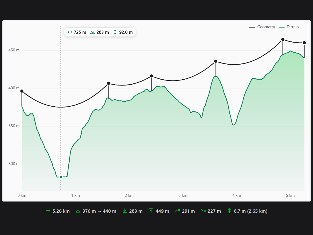
Height above sea level along the line, with length, lowest and highest point, total ascent and descent.
Draw a line on the map and see the terrain under it as an elevation profile. Give every point a pole height, set the cable sag and Geisro shows the ground clearance of the overhead line along the whole route, including every place where the cable would touch the ground.
5 m terrain model · pole heights · sag per 100 m span · ground clearance check
From a quick look at the terrain along a route to checking where a power line, a telecom cable or a fibre optic aerial cable needs taller poles.
Height above sea level along the line, with length, lowest and highest point, total ascent and descent.
Every point of the line is a pole with its own height above the terrain.
One sag per 100 m span; each span sags with the square of its length, as a parabola.
Minimum clearance of the cable and every place where it would touch the ground, in red.
Drag a point to change its height, slide it along the route, double-click to add a pole.
Span length, total distance, sag, terrain and altitude of every pole in one table.
Pole heights and sag are stored with the geometry and stay put when you edit the line.
Hover the chart for distance from the start, terrain altitude and cable height above the ground.
A profile of the ground under a planned route answers the first question of every overhead line: where do the poles have to be taller, and which span is too long? Geisro gives you the answer on the map, without desktop GIS or a CAD tool.
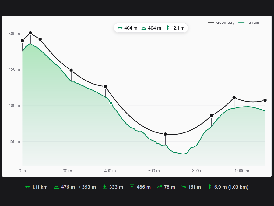
The sag of a span grows with the square of its length: at 2 m per 100 m, a 150 m span sags 4.5 m and a 300 m span 18 m. That is why a single long span over a valley is usually the first place a cable gets too close to the ground.
Heights come from official open digital terrain models, not from the map tiles. Today Geisro covers the Czech Republic with the 5 m digital terrain model DMR 4G (bare ground from airborne laser scanning, © ČÚZK), and more countries are on the way. A line that leaves the covered area shows a hatched "no data" gap, and every such country is recorded, so we know where to add terrain data next.
A cross-section of the terrain along a line: the height above sea level plotted against the distance from the start. Geisro draws it for any line on the map and adds the length, lowest and highest point, total ascent and descent.
You enter the sag at the middle of a 100 m span. Each span then sags as a parabola by that value times the square of its length divided by 100 m, so a 200 m span sags four times as much. It models one cable with one tension along the whole line.
Yes. Geisro shows the minimum clearance between the cable and the terrain and where it occurs, and highlights in red every place where the cable would go below the ground.
Its own copy of official open terrain data. Today that is the Czech Republic with the 5 m model DMR 4G from ČÚZK; more countries are being added.
No. It is an approximate calculation for planning and checking routes: one state, a parabola, without temperature, ice or wind load. A real overhead line design must follow the applicable standards.
The elevation profile, pole heights and cable sag are included in the Pro, Ultra and Team plans, with no limit on the number of profiles - see pricing.
N 50.7360 E 15.7397 · GEISRO ELEVATION PROFILE