
01
Opens in seconds
No download, no installation, no licence keys. Runs in any modern browser on Windows, macOS and Linux.
Geisro is an online, browser-based map editor for surveyors, engineers, planners and utility teams - sketch polygons and routes, read distance and area as you go, and keep it all in private or shared projects and layers.
Free to start · sign in with Google or Microsoft · no install
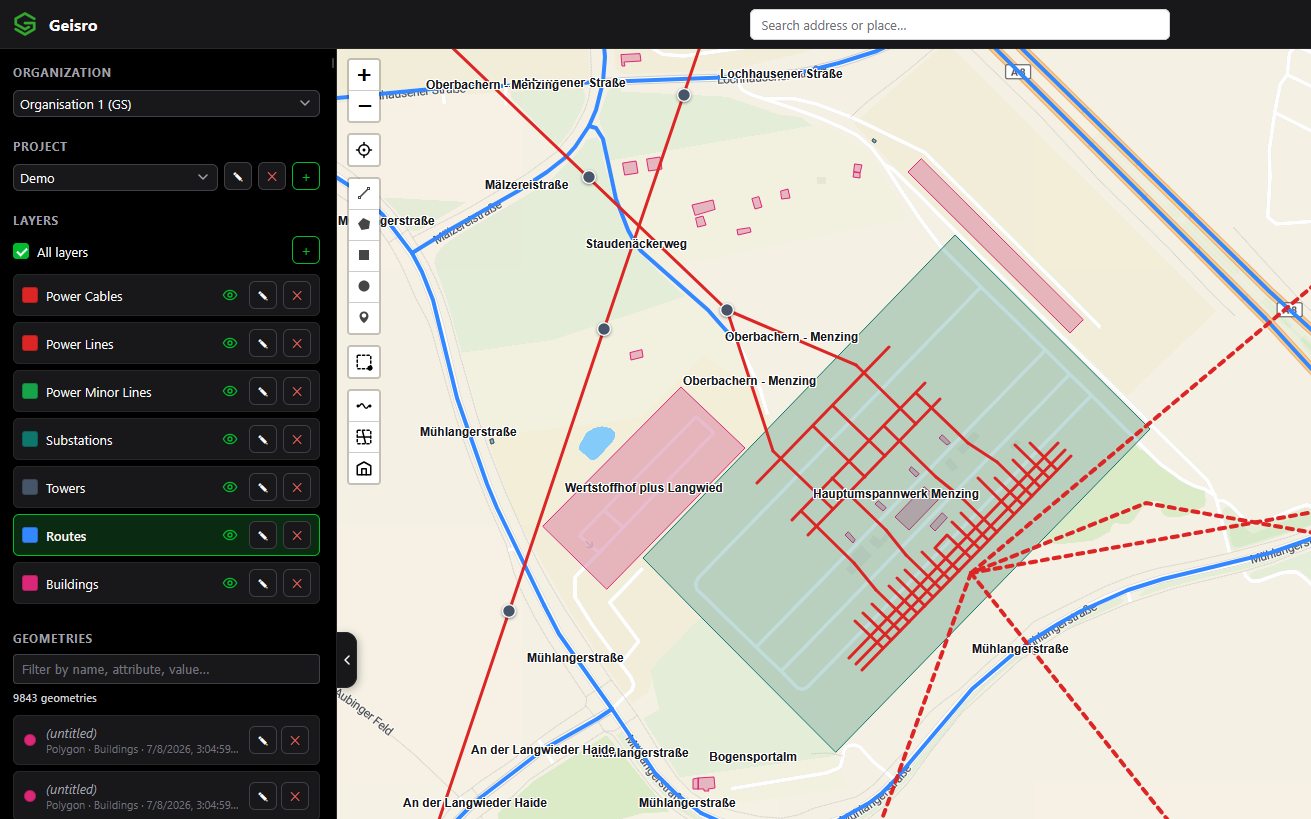
Geisro is an online GIS map editor for businesses and individuals who need to mark up a map without opening heavyweight desktop GIS software. Everything is saved to your account, organised in projects and layers and ready to export.
No download, no installation, no licence keys. Runs in any modern browser on Windows, macOS and Linux.
Distance and area are computed geodesically on the real Earth, so they stay accurate at any scale.
Organisations, shared projects and layers. Everyone works on the same map instead of passing files around.
GeoJSON in and out, the whole layer or just a selection. Nothing is locked in.
| Desktop GIS | Geisro | |
|---|---|---|
| Getting started | Download, install, configure | Open the browser and sign in |
| Learning curve | Days of training | Productive in minutes |
| Updates | Manual upgrades | Always the latest version |
| Working together | Send files back and forth | Shared projects and layers |
| Where it runs | The machine it is installed on | Any computer with a browser |
Desktop GIS is still the right tool for heavy spatial analysis. For everyday drawing, measuring and sharing, Geisro gets you there faster.
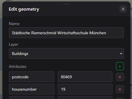
Place points, trace lines and close off polygons - fields, zones, buildings, boundaries. Give each shape a name and custom attributes, so your map carries real information, not just outlines.
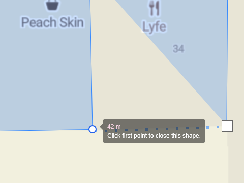
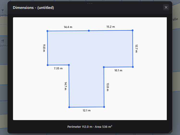
Distance and area are computed geodesically, on the real Earth, so the numbers stay honest at any scale. Units switch themselves; select several shapes and Geisro totals them.
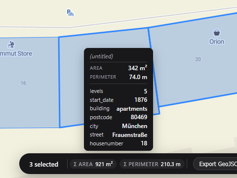
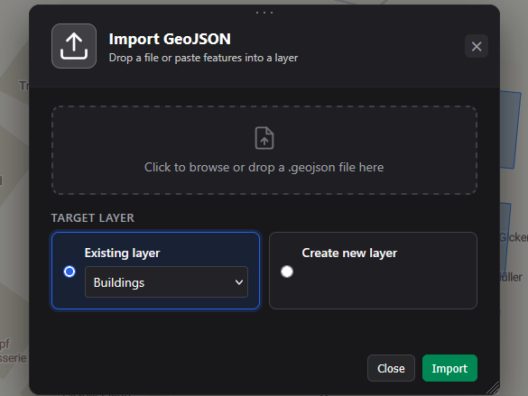
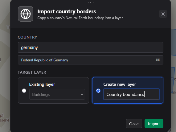
Drop a GeoJSON file straight onto a layer and edit its features visually. Export the whole layer, or just the geometries you select. Pull in any country's border from Natural Earth with a single search.
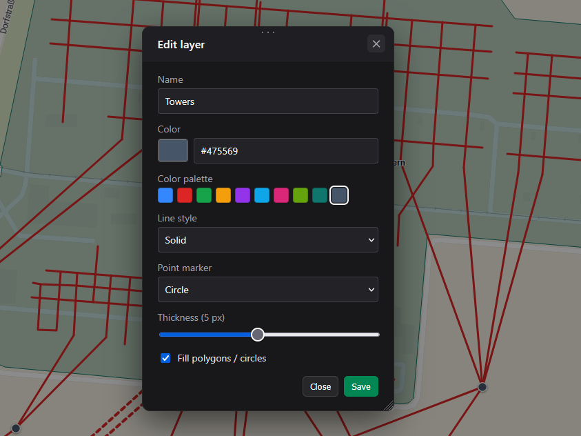
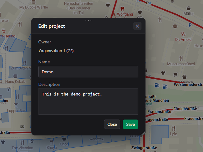
Keep work tidy with multiple projects and colour-coded layers, custom attributes and a fast filter. Create an organisation, add members and share projects so your whole team maps together in one place.
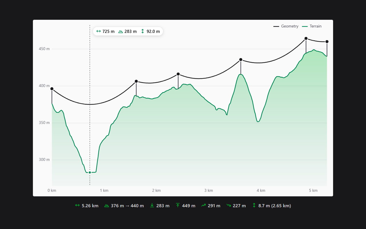
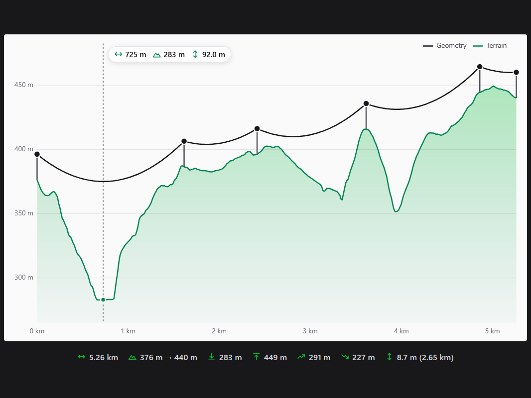
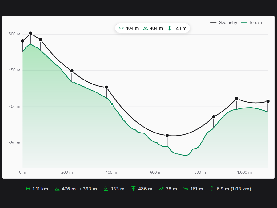
Open the elevation profile of any line to see the terrain under it. Give each point a pole height, set the cable sag per 100 m span and see the ground clearance of an overhead power, telecom or fibre line - with every spot where the cable would touch the ground in red.
Free to start · no install
Surveyors, engineers, planners, utility and logistics teams - anyone who needs a map with real information and real numbers on it.
Outline parcels, fields and building plots and read their area in m² or ha.
Plan overhead lines and check terrain, pole heights and ground clearance.
Trace a route and get its exact length, segment by segment.
Capture points with names and custom attributes, then export them to GeoJSON.
Draw zones as polygons and colour-code them by layer.
Plan a route along the road network and save it with the project.
Annotate a construction or event site with labelled shapes the whole team can see.
Open a GeoJSON file, fix its features visually and export it again.
Use your Google or Microsoft account. No separate password, nothing to install.
Place points, lines and polygons, plan routes, and read distance and area live.
Sort into projects and layers, share with your team, export to GeoJSON anytime.
Sketch any shape and watch the area update in real time.
Segment and total length as you draw.
Routing along the road network.
Drop a file onto any layer.
Whole layer or a selection.
Natural Earth data in one search.
Attributes, colours and filtering.
Shared organisations and projects.
Terrain profile along any line.
Sag per span, set once per line.
See where a cable would touch the ground.
Height above terrain for every point.
We are building fine-grained permissions for organisations. Soon you will give each member a role - Owner, Editor or Reader - so you decide exactly who can manage the team, who can edit projects and layers, and who can only view them.
Sign in with a Google or Microsoft account and draw, save and organise maps and import and export GeoJSON for free. Paid plans (Pro, Ultra and Team) raise the limits and add measurements, more route planning and map data import.
No. Geisro runs entirely in your browser. There is nothing to download - just open the map editor and start drawing.
Yes. Import GeoJSON files into any layer and edit the features visually, and export the active layer - or just the geometries you select - to take your data elsewhere.
Yes. Geisro shows the length of lines and the area of polygons as you draw, and a dimensions view labels every side.
Yes. Select any line and open its elevation profile to see the terrain along it. Set pole heights and a cable sag per 100 m span to check the ground clearance of an overhead power or fibre line. Included in the Pro, Ultra and Team plans.
Yes. Create an organisation, add members and share your projects and layers. Role-based permissions (Owner, Editor, Reader) are coming soon.
N 52.5163 E 13.3777 · GEISRO ONLINE MAP EDITOR